New Mobile Site
We have just launched a new mobile version of this site - m.trainspots. This page will use your smart device's GPS to loctate you and guide you to locations that are close to your present location.
Location notes
Between Stirling and Perth on the Highland mainline, a few miles south of Gleneagles.
Railway type and traffic
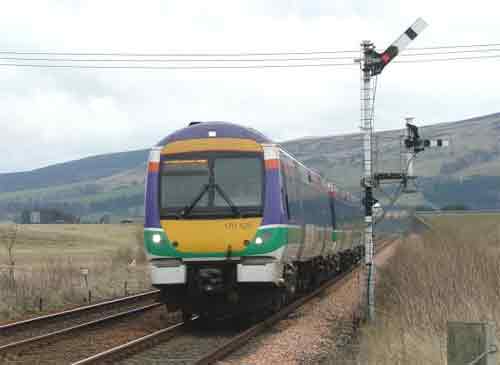
First Scotrail services between Edinburgh ( not those via Fife ) / Glasgow and Inverness , also services Glasgow to Aberdeen. East Coast Highland Chieftain service and the Caledonian sleeper for Inverness.
Freight consists of DB Schenker services between Mossend and Inverness / Aberdeen ( 66 ) oil tanks to Linkswood ( Monday morning ) ( 60 or 66 ) and class 67 on vans. DRS Grangemouth - Aberdeen ( 66 ) runs every day including Sunday. Freightliner 66 on cement to / from Aberdeen and Inverness.
Freight consists of DB Schenker services between Mossend and Inverness / Aberdeen ( 66 ) oil tanks to Linkswood ( Monday morning ) ( 60 or 66 ) and class 67 on vans. DRS Grangemouth - Aberdeen ( 66 ) runs every day including Sunday. Freightliner 66 on cement to / from Aberdeen and Inverness.
Environment
On the outskirt of a small town, rural setting.
Road directions
From the A9 , north or south , take the turnoff which is signposted Blackford, continue straight through the town to the level crossing. Park here.
Then by foot , cross over the crossing, take the road immediately on the left, a few yards further on ( as the road bends away ) access can be gained through the field (public right of way) then either climb up the hill or continue along the 'path' to your chosen spot . If you go beyond the first style other pictures ( not shown ) can be obtained.
Click here to set up your location for directions to this location
Blackford map co-ordinates
Parking
There is some on road parking by the location
Public transport
The nearest station is Gleneagles.
Take the train to either Stirling / Gleneagles / Dunblane or Perth then Bus.
Click here to set up your location for directions to this location
Take the train to either Stirling / Gleneagles / Dunblane or Perth then Bus.
Click here to set up your location for directions to this location
Amenities
There are some Shops and Pubs in the town.
Sun Compass
Sun Compass using Suncalc by brought to you by Vladimir Agafonkin:
It might be necessary to adjust the time to suit your visit, this link should open with the current day.
Blackford
Streetmap links
Blackford general view map
Blackford close up map
Windows Local Live Link - image quality may vary
Blackford
It might be necessary to adjust the time to suit your visit, this link should open with the current day.
Blackford
Googly map
Blackford general view map
Blackford close up map
Windows Local Live Link - image quality may vary
Blackford
Who likes this location on facebook
Railway Gen Group
Photographic notes
Light is best from town side of the level crossing , most of the day. From the path / hill location you are against the light. Having said that, very good shots can still be obtained.
Those wishing to video would be better off at the hill location, though the road at the crossing is steady rather than busy for traffic, there can be a fair amount of lorries going into the adjacent ' Spring water' warehouse.
It is worth noting that all featured pictures were taken between 10.45 and 12.45
General views - All photographs © Steven Wakefield unless otherwise stated
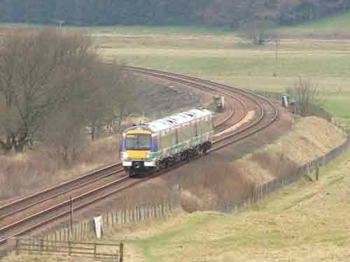
Fig 1 - Looking south
The view towards Stirling
Fig 2 - Looking south
As above but using telephoto
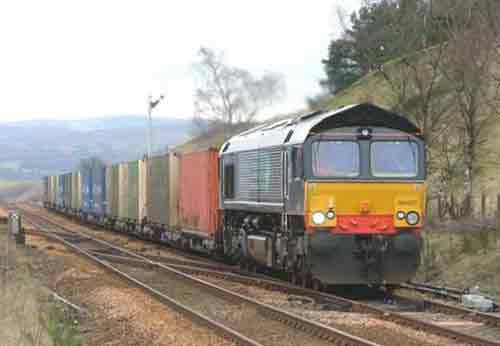
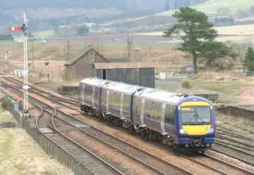
Fig 3 - Looking north
Looking in the Perth direction from the Level Crossing.
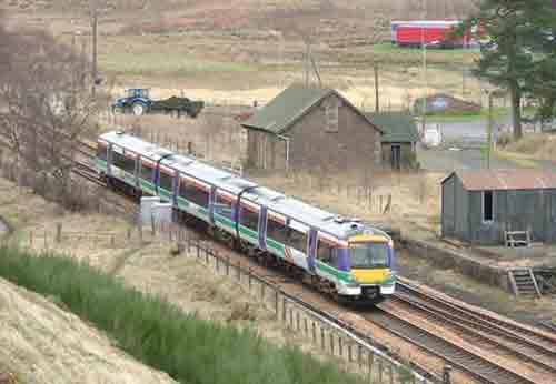
Fig 4 - Looking north
From the road
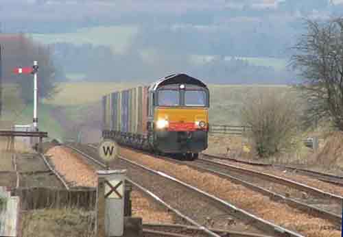
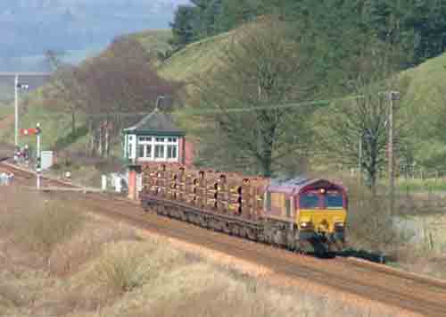
Fig 5 - Looking south
From the path
Fig 6 - Looking north
From the path
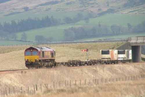
Fig 7 - Looking north
From the hill
Fig 8 - Looking south
Disclaimer
All information contained within this is site is © Trainspots. The images used on this site remain the property of the original photographer, as credited at the top of the page, and are used with their kind permission.
The information on these pages is supplied for the benefit of railway enthusiasts who carry out a harmless hobby, and through the medium of photography and video, actually promote the railway industry. Railway enthusiasts can also act as eyes and ears against railway vandalism, and as such should surely be encouraged to do so by the supply of adequate information such as is found on this website.
This site has been created to assist railway photographers in their travels around the country. It is based on the personal knowledge and experience. No liability can be held against the web site or its contributions for incorrect information. Trainspots will endeavour to check all information and corrections will be accepted and posted accordingly.
Advice as to the locations general environment is given as a guide on each page. This information is a GUIDE only. ALWAYS be careful with your equipment, Trainspots can not be held responsible for your personal security. Avoid leaving your property on display for all to see, be aware of your surroundings at all times. There are, sadly, people who will not think twice about trying to steal your equipment.
Trainspots DOES NOT condone trespass and none of the information on this site should be taken as a right to trespass on either railway or private land. To the best of our knowledge all locations are publicly accessible areas, where they are not contact information will be given to the appropriate authority for permission to be obtained.
The content of this site is created and intended for all age ranges but the content of sites linked from this site are not subject to the same intentions. Trainspots will attempt to check links for validity but as time passes and the site grows this will not always be possible. Broken, or indeed updates to, links should be submitted to the editor for inclusion in the updates. All links external to the Trainspots site are opened in a new browser window. Trainspots has been running now for over 10 years and there are imitation sites and guides to railfotspots. But we are a free site and we continue on the path we started out on over a decade ago to provide a useful guide to UK Railway Photographic Locations.