New Mobile Site
We have just launched a new mobile version of this site - m.trainspots. This page will use your smart device's GPS to loctate you and guide you to locations that are close to your present location.
Location notes
Located to the west of Dunfermline.
The branch starts at Charlestown Junction just to the south of the viaduct at Dunfermline Town station and runs downhill past Elbowend Junction where the mothballed line to the MOD Armament Depot at Crombie branches to the south.The line continues through the villages of Crossford and Cairneyhill
It then it runs alongside the Firth of Forth at the villages of Torryburn and Newmills. The branch then turns inland for a short stretch when the ash lagoons separate the line from the shore running by the side of a small collection of cottages known as Low Valleyfield, once entering the ancient village of Culross (pronounced Coo-russ) when it regains the shore until turning to bisect the power station.
Railway type and traffic
There is no passenger service on this line
Single line from Charlestown Junction until the start of the power station unloading roads.
Traffic is now made up of DB Schenker Class 66s hauling HAA type mgr wagons. It takes about twenty minutes from an empty train passing you at Culross to the earliest chance of a full one coming the other way as there are a number of 10 m.p.h restrictions on the branch.
Link to Real Time Trains
RTT Link Longannet - Sub Sector Bridge
This link should be close to the location, but may not be the actual location so please check the page. This link will take you to what is happening 'around now'. Dates and times can be changed at the top of the page.
This link should be close to the location, but may not be the actual location so please check the page. This link will take you to what is happening 'around now'. Dates and times can be changed at the top of the page.
Environment
Very rural once clear of Dunfermline.
Road directions
From the Forth Road bridge
Take the first exit (Junction 1) after crossing into Fife, sign posted North Queensferry and Rosyth. Take the second exit at this roundabout and the first exit at the following roundabout, sign posted for Rosyth Euro Terminal. Continue on this road until you reach a third roundabout , take the second exit (Hilton Road) and continue along this road, passing the Royal Naval Shore establishment HMS CALEDONIA on your left hand side until you reach yet another roundabout. Take the second exit here and less than 100 yards you come to a T junction, turn left onto the A985 and follow this road until you pass under the mothballed line to Crombie Armament Depot, turn right up a side road signposted Crossford. This road goes under the Longannet Branch. When you reach a set of traffic lights, here turn left onto the A994 and continue for about two miles into Cairneyhill village passing a petrol station (not cheap) on your right and a pub called The Maltings again on your right. Turn left into Muirside Lane about 100 yards past the pub, this lane has quite a number of potholes so drive slowly. Continue along to the end of this lane, which crossed the railway. Where it makes a T junction with the A985, turn right and follow the road to a large roundabout. Take the first exit onto the B9037. The location is the first railway bridge. It is easy to spot as the bridge has been painted with the old coal sub sector logo, black diamonds on a yellow background for those new to the hobby since privatisation :o)
Click here to set up your location for directions to this location
Longannet - Sub Sector Bridge map co-ordinates
Parking
There is plenty of parking space on the left just over the bridge.
Public transport
Amenities
The closest facilities will be back at Cairneyhill village where there are two village shops, a coffee shop with home baking in the garden centre, two pubs and a petrol station, no public toilets.
Sun Compass
Sun Compass using Suncalc by brought to you by Vladimir Agafonkin:
It might be necessary to adjust the time to suit your visit, this link should open with the current day.
Longannet - Sub Sector Bridge
Streetmap links
Longannet - Sub Sector Bridge general view map
Longannet - Sub Sector Bridge close up map
Windows Local Live Link - image quality may vary
Longannet - Sub Sector Bridge
It might be necessary to adjust the time to suit your visit, this link should open with the current day.
Longannet - Sub Sector Bridge
Googly map
Longannet - Sub Sector Bridge general view map
Longannet - Sub Sector Bridge close up map
Windows Local Live Link - image quality may vary
Longannet - Sub Sector Bridge
Who likes this location on facebook
Railway Gen Group
Photographic notes
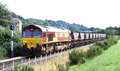
Another location is an occupation bridge on the left hand side of the road visible from the sub sector bridge (Fig 3), and another photographic spot is just a bit further along the road where you can see a track passing under the railway (Figures 4 and 5)
General views - All photographs © Peter Kellett unless otherwise stated
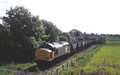
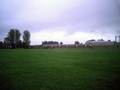
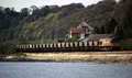
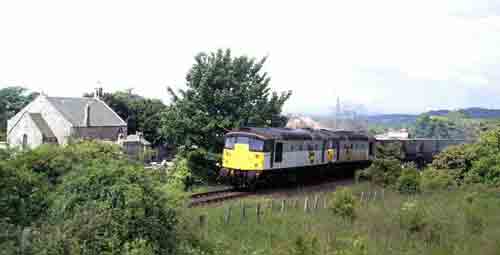
Fig 1 - Looking east
Shadows from the banks???
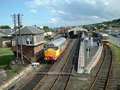
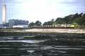
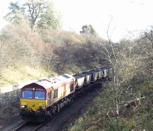
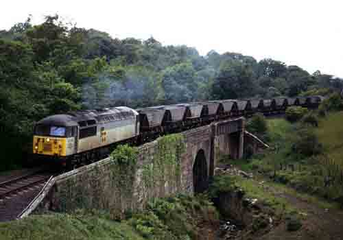
Fig 2 - Looking west
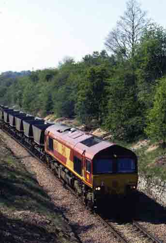
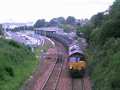
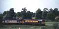
Fig 3 - Looking east
From Occupation bridge.
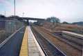
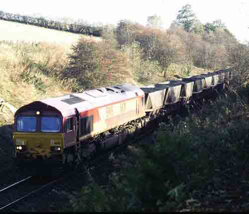
Fig 4 - Looking west
From the overbridge near Torryburn
Fig 5 - Looking west
From the overbridge near Torryburn
Disclaimer
All information contained within this is site is © Trainspots. The images used on this site remain the property of the original photographer, as credited at the top of the page, and are used with their kind permission.
The information on these pages is supplied for the benefit of railway enthusiasts who carry out a harmless hobby, and through the medium of photography and video, actually promote the railway industry. Railway enthusiasts can also act as eyes and ears against railway vandalism, and as such should surely be encouraged to do so by the supply of adequate information such as is found on this website.
This site has been created to assist railway photographers in their travels around the country. It is based on the personal knowledge and experience. No liability can be held against the web site or its contributions for incorrect information. Trainspots will endeavour to check all information and corrections will be accepted and posted accordingly.
Advice as to the locations general environment is given as a guide on each page. This information is a GUIDE only. ALWAYS be careful with your equipment, Trainspots can not be held responsible for your personal security. Avoid leaving your property on display for all to see, be aware of your surroundings at all times. There are, sadly, people who will not think twice about trying to steal your equipment.
Trainspots DOES NOT condone trespass and none of the information on this site should be taken as a right to trespass on either railway or private land. To the best of our knowledge all locations are publicly accessible areas, where they are not contact information will be given to the appropriate authority for permission to be obtained.
The content of this site is created and intended for all age ranges but the content of sites linked from this site are not subject to the same intentions. Trainspots will attempt to check links for validity but as time passes and the site grows this will not always be possible. Broken, or indeed updates to, links should be submitted to the editor for inclusion in the updates. All links external to the Trainspots site are opened in a new browser window. Trainspots has been running now for over 10 years and there are imitation sites and guides to railfotspots. But we are a free site and we continue on the path we started out on over a decade ago to provide a useful guide to UK Railway Photographic Locations.